The Virginia Creeper Trail
Welcome to Along For The Ride Vacation Rentals
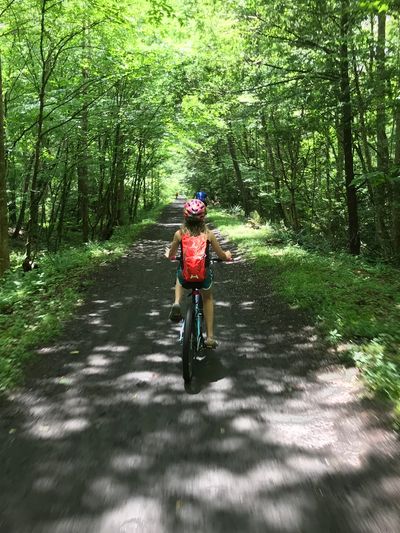
The Virginia Creeper Trail is a 34-mile paved-and-gravel rail trail in southwest Virginia that runs from Abingdon through Damascus to Whitetop Station. It follows an old railroad bed, which means:
- Gentle grades (especially Damascus → Whitetop, which is mostly downhill)
- Ideal for biking, walking, running, and horseback riding
- One of the most scenic multi-use trails in the eastern U.S.
- Damascus sits right on the trail and is often called the heart of the Creeper.
- Best photo spots & landmarks (mile-by-mile highlights)
Whitetop Station (mile ~34)
- Highest elevation on the trail
- Mountain meadows, open skies, dramatic weather
- Classic “start of the ride” photos
- Photo tip: Early morning fog rolling over the fields = gold.
Green Cove Station (mile ~30)
- Wooden trestles
- Creek crossings
- Deep forest feel
- Best shots: Bridges framed by rhododendron in spring.
Trestle Bridges (multiple locations)
The trail crosses 30+ wooden trestles, especially between Green Cove and Damascus.
Iconic Creeper photos:
- Long straight bridges disappearing into trees
- Cyclists centered on the spa
- Reflections in calm water below
Damascus Town Park (mile ~17)
Damascus Town Park
- Trail runs directly through town
- River access, bridges, open lawns
- Easy access to food, coffee, and gear shop
- Great for: Trail-town vibe shots with bikes, signs, and people.
Laurel Creek Gorge (Damascus → Abingdon)
Laurel Creek
- Creek hugs the trail for miles
- Waterfalls after heavy rain
- Autumn color reflection
- Fall foliage hotspot — probably the most photographed section.
Abingdon Trailhead (mile 0)
Abingdon
- Historic brick trestle
- Access to restaurants, arts, and the Barter Theatre area
- Urban-meets-nature compositions work well here.
Seasonal highlights
- Spring: Wildflowers & rhododendron
- Summer: Cool creek air and shade
- Fall: Nationally famous foliage
- Winter: Quiet, snowy, and photogenic (some services closed)